qgis2web

qgis2web is a QGIS plugin to export your project to an OpenLayers or Leaflet webmap. It replicates as many aspects of the project as it can, including layers, extent and styles (including categorized and graduated). No server-side software is required to display the web maps.

qgis2web

qgis2web-osgeologo

From your QGIS project to an interactive web map, with zero coding

Turn your QGIS map into a shareable web page in just a few clicks.

What it is

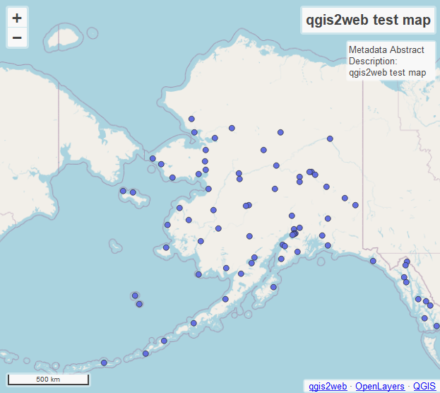
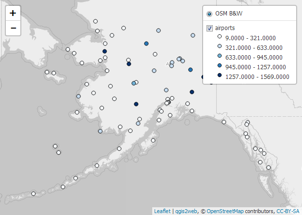
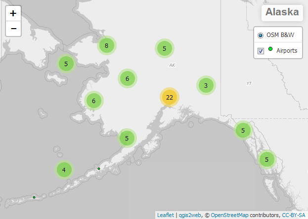
qgis2web is a QGIS plugin that exports your map to an interactive web page.
It produces static files (HTML, JavaScript, CSS) that work immediately in a browser, both online and offline.

Who it’s for

  • GIS staff in public agencies and private companies
  • Consultants and professionals sharing results with decision-makers and stakeholders
  • Teachers and students who want to publish maps without learning to code

What it lets you do

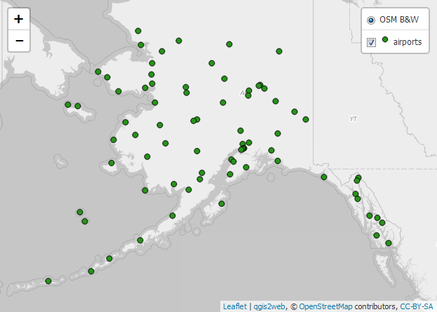
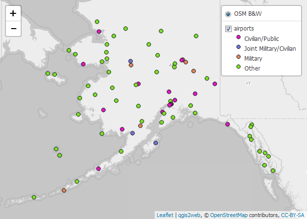
  • Publish your key layers and styles directly from QGIS to the web
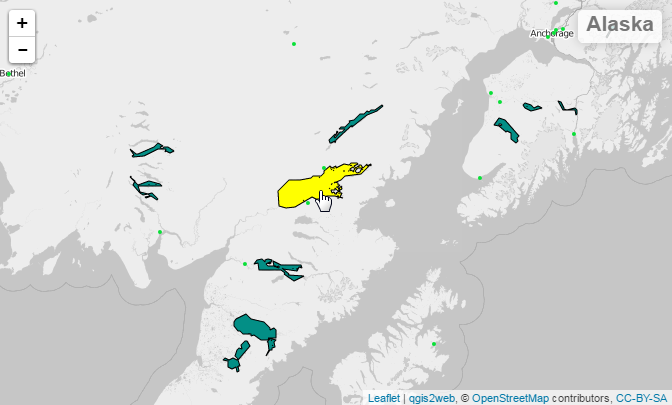
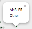
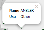
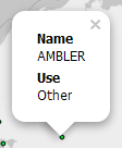
  • Create informative pop-ups with text and images
  • Add useful tools: layer switcher, measurement, search, geolocation
  • Choose between two popular web map libraries: Leaflet or OpenLayers
  • Generate a static site that’s easy to host on GitHub Pages or a simple web server

Why use it

  • No coding required
  • Fast: from QGIS map to sharing in minutes
  • Control: the files are yours and work even without an internet connection
  • Open source and widely supported technologies

When to use it

  • Great for: project presentations, public consultations, lightweight story maps, rapid prototypes
  • Not suited to: complex web apps with authentication, online editing, or server-side analysis

How it works in 3 steps

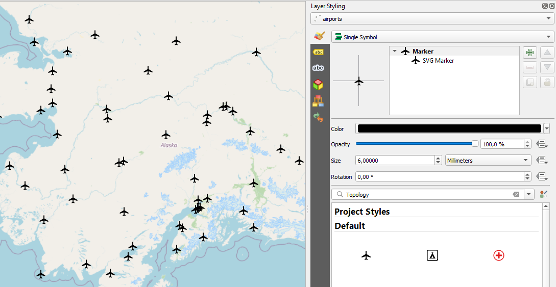
  1. Prepare your QGIS map: give clear names to layers and fields you want in pop-ups.
  2. Open qgis2web (Web menu): choose Leaflet or OpenLayers and the tools you need.
  3. Export: get a folder with your web map ready to open in a browser or publish online.

Requirements & compatibility

  • QGIS 3.x (Windows, macOS, Linux)
  • Static HTML/JS/CSS output compatible with any simple web server (including GitHub Pages)

Recognition

Winner of OSGeo:UK 2024 (GoFundGeo).


Core features

  • 🌍 Export Options

    • Export QGIS projects to interactive web maps
    • Support for OpenLayers and Leaflet libraries
    • Export as HTML, JavaScript, and CSS files
    • Create fully standalone web maps without server dependencies
  • 🗺️ Layer and Data Support

    • Support for vector layers (points, lines, polygons)
    • Support for raster layers
    • Attribute data export for popups
    • Filtering and limiting the number of exported features
    • Retain symbology and styles from QGIS layers
  • 🎨 Styling and Appearance

    • Preserve categorized and graduated symbology
    • Custom marker icons and colors
    • Export labels and tooltips
    • Control layer opacity and visibility
    • Basemap (e.g., OSM, Google, Bing)
  • 🧭 Interactivity and Tools

    • Automatically generate feature popups
    • Enable measure tools (distance, area)
    • Add search functionality by attribute
    • Toggle layer visibility in the legend
  • ⚙️ Configuration and Customization

    • Configuration panel to preview the web map before export
    • Customize popup content
    • Choose coordinate reference systems (CRS)
    • Define map scale and zoom levels
    • Option to minify output files
  • 🧩 Integration and Extensibility

    • Embed exported maps into websites
    • Easily integrate with existing web applications
    • Extend functionality with custom JavaScript
    • Open output directly in browser for immediate testing

Implemented Standards

  • Geographic JSON (GeoJSON)
  • Georeferenced Tagged Image File Format (GeoTIFF)
  • Open Geospatial Consortium (OGC)
  • OpenStreetMap (OSM)
  • Web Map Tile Service (TMS)
  • Web Feature Service (WFS)
  • Web Map Service (WMS)
qgis2web sig marker


Export Examples:


Project title and Project abstract

Project Title and Abstract Example

Highlight on hover

Highlight on Hover Screenshot

Single symbol

Single Symbol Renderer

Categorized

Categorized Symbol Renderer

Graduated

Graduated Symbol Renderer

SVG Marker

SVG Marker

Cluster

Cluster point features

Popup fields

Specify how each field will be labeled in pop-ups

No Label Inline Label Header Label
no label inline label header label