Gisquick

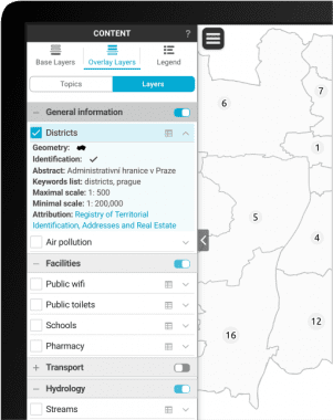
Gisquick is designed as an open source platform for publishing geospatial data in the sense of rapid sharing QGIS projects on the web. The platform consists of QGIS plugin, Django-based server application, QGIS server, and web/mobile clients. The clients are designed with a goal to put together minimal set of functions for useful generic responsive web and mobile friendly mapping application.
The process of data publishing with Gisquick is quite easy. For client-server communication Gisquick uses open OGC standards, namely WMS, WMTS and WFS services. Server components can be easily deployed in Docker containers serving your GIS projects from the cloud or from your own hardware. Project creators only needs QGIS desktop software with Gisquick plugin installed.
The platform is designed to be applicable in everyday practice and/or for further custom development. More relevant information about Gisquick’s development, including source code, deployment and support for users is published on GitHub.


