We would like to dedicate this version to our friend Malena Libman who passed away shortly before OSGeoLive 14.0 was released. FOSS4G 2021 Buenos Aires was her dream. Farewell Malena, we will miss you.
Release Highlights
Highlights for this release include:
- Based on Lubuntu 20.04.1 Focal
- New applications pygeoapi, Re3gistry, GeoStyler.
- Version updates to most of the included packages.
- The Virtual Machine version now includes applications that could not fit into the iso version. List of VM only applications available here.
- Additional Python modules like Fiona, rasterio, cartopy, pandas, geopandas, mappyfile, Jupyter.
- Improved documentation and four new translations, now supporting: English | Deutsch | Español | Suomen kieli | Français | Italiano | 日本語 | Hungarian.
- 100 % translation to Hungarian. Zoltán Siki, one of the Hungarian translators, pointed out the need for the translation and will use it at GIS courses at University in Budapest.
- 100 % translation to Spanish. Special thanks to Martha Vergara that did 99% of the translation.
- Command line introduction.
- Improved Quickstart for OpenStretMap? thanks to Enock Seth Nyamador.
Marco Minghini, Scientific Project Officer at the European Commission, says “Open source geospatial software is a key building block of many data infrastructures managed and operated by the European Commission, powering high-level, pan-European initiatives such as INSPIRE and Copernicus. The role of OSGeoLive to teach and promote the use of open source geospatial software has no equivalent. Big thanks to OSGeo and the OSGeoLive team!”
OSGeoLive 14 is ready to be used at events. It will be used at FOSSGIS Konferenz 2021 in June and FOSS4G 2021 in September 2021.
Download
Download the OSGeoLive 14.0 image at https://live.osgeo.org/en/download.html
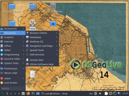
About OSGeoLive
OSGeoLive is a Lubuntu based distribution of Geospatial Open Source Software, available via a Virtual Machine, USB and DVD. OSGeoLive is pre-installed with robust open source geospatial software, which can be tried without installing anything.
It includes:
- Close to 50 quality geospatial Open Source applications installed and pre-configured
- Free world maps and sample datasets
- Project Overview and step-by-step Quickstart for each application
- Lightning presentation of all applications, along with speaker’s script
- Translations to multiple languages
Credits
Hundreds of people have directly helped with OSGeoLive packaging, documenting and translating, and thousands have been involved in building the packaged software. Thank you to all involved.
Sponsoring organisations
- OSGeo – the Open Source Geospatial Foundation provides development & hosting infrastructure for OSGeoLive and many of the included applications.
- Information Center for the Environment (ICE) at the University of California, Davis provides hardware resources and development support.
- Remote Sensing Laboratory at the National Technical University of Athens, provides hardware resources and development support.
- The Debian GIS and UbuntuGIS teams provide and quality-assure many of the core packages.
- Okeanos is kindly providing Virtual Machines for building the OSGeoLive iso images.

