
About Manya Technologies
Manya Technologies, founded in 2023 and headquartered in Bangalore, India, is a software company specializing in open-source GIS solutions for government, defense, and enterprise clients. Our focus is on building real-time, cross-platform applications using technologies like QGIS, PostGIS, Qt/C++, and CesiumJS.
We are the creators of PrithviGIS – a powerful, QGIS-based GIS application that supports real-time radar and GPS track display, PostgreSQL/PostGIS sync, advanced symbology, and mission planning tools.
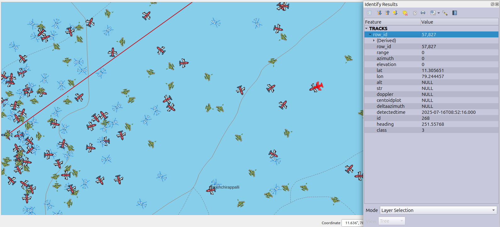
PrithviGIS – Real-time radar and GPS track display in a QGIS-powered application
Live Demo by Manya Technologies
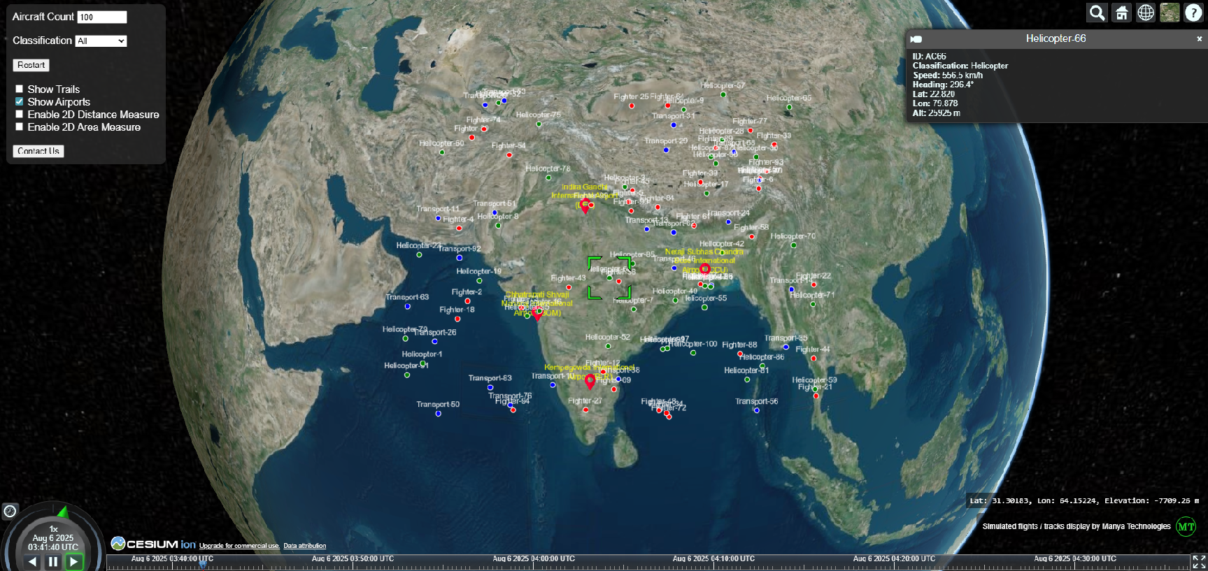
We also integrate CesiumJS – a popular open-source 3D geospatial visualization engine – in our GIS tools for real-time, Qt Webview / browser-based track display and simulations.
See our real-time 3D track simulation using CesiumJS here:
Real-Time Aircraft Track Visualization Demo
Services We Offer
- Custom QGIS plugin development and Python/Qt integration
- Real-time sensor and radar data visualization
- GIS desktop, web, and mobile application development
- PostgreSQL/PostGIS schema design and integration
- Simulation tools for aerospace and defense
- WebSocket, UDP, and TCP-based live data streaming
- Modernization of legacy GIS/C++ systems
GIS Solutions & Technology Stack
- QGIS / PyQGIS / QGIS Server
- PostgreSQL / PostGIS
- Qt (C++ / Python)
- CesiumJS for 3D visualization
- OGC standards (WMS, WFS, WMTS)
- Cross-platform development for Windows, Linux, and Android
Our Vision
To become a trusted partner in delivering innovative, open-source geospatial solutions that empower decision-makers in defense, infrastructure, and environmental sectors.
Our Values
- Integrity: Honest and transparent communication
- Timely Delivery: We meet critical deadlines without compromising quality
- Innovation: Embracing cutting-edge, open-source technologies
- Reliability: Scalable, mission-ready software systems
Project Expertise
- PrithviGIS – QGIS-based application for real-time radar/GPS track display
- CesiumJS Demo – Real-time 3D aircraft tracking in a browser (not part of OSGeo, but open-source)
- Qt-based sensor and radar simulators
- Custom GIS map viewer framework with symbology, temporal layers, and live updates
- PostgreSQL/PostGIS-based live data dashboards
